
SERVICES
PROFESSIONAL DRONE SOLUTIONS FOR EASTERN OREGON
Jaxen Creek Drone Services provides professional aerial imaging, thermal, multispectral, mapping, inspection, and geospatial services for agriculture, ranching, property, infrastructure, businesses, and other applications throughout Eastern Oregon.
FAA Part 107 Licensed • Fully Insured • Based in Baker City, Oregon
OUR CAPABILITIES
THE RIGHT AERIAL SOLUTION FOR THE PROJECT
Different projects require different aircraft, sensors, flight plans, and deliverables. JCDS works with customers to understand the objective first, then develops an aerial data collection approach appropriate to the project.
From multispectral agricultural imagery and thermal inspections to detailed mapping and professional aerial media, our goal is to turn aerial technology into useful information.
AGRICULTURAL IMAGING
Multispectral and high-resolution aerial imagery for crop, pasture, field, irrigation, and vegetation assessment.
INSPECTIONS
Aerial inspection of roofs, structures, fences, infrastructure, facilities, and difficult-to-access areas.
THERMAL IMAGING
Thermal and visual imaging for inspections, livestock applications, search operations, infrastructure assessment, and temperature-related observations.
AERIAL MEDIA
Professional aerial photography and video for real estate, commercial properties, development, tourism, and marketing.
MAPPING & GEOSPATIAL
Orthomosaics, property mapping, elevation information, site documentation, and other geospatial deliverables.
SPECIALIZED SERVICES
Purpose-built aerial operations for ranches, feedlots, mining properties, golf courses, resorts, wineries, and other specialized applications.
AGRICULTURE & RANCHING
AERIAL INFORMATION FOR BETTER FIELD AND PROPERTY VISIBILITY
Drone imagery provides a different perspective on agricultural operations by allowing large areas to be documented efficiently and spatial patterns to be evaluated across fields, pastures, and properties.
JCDS combines high-resolution visual, multispectral, thermal, and mapping capabilities to support farmers and ranchers with aerial information tailored to the property and objective.
AGRICULTURAL SERVICES
• Multispectral field imaging
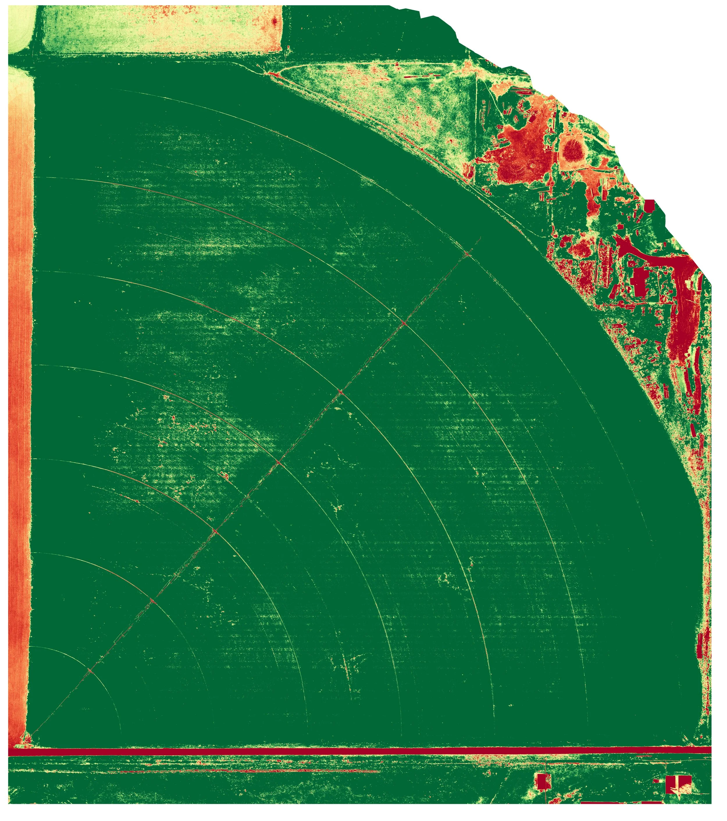
• NDVI and vegetation-index mapping
• Crop and vegetation variability assessment
• Pasture condition documentation
• Seasonal field monitoring
• Irrigation and pivot inspection
• Field and property orthomosaics
• Drainage and water-pattern documentation
Multispectral and thermal imagery provides observational information and should be interpreted alongside field conditions and appropriate agricultural or veterinary expertise when making management decisions.
RANCH & LIVESTOCK SERVICES
• Fence and perimeter inspection
• Pasture monitoring
• Livestock observation from the air
• Thermal livestock observation
• Water and infrastructure inspection
• Fire-risk and vegetation documentation
• Ranch property mapping
• Lost livestock aerial search
THERMAL IMAGING
SEE TEMPERATURE DIFFERENCES THAT VISUAL IMAGERY CAN'T SHOW
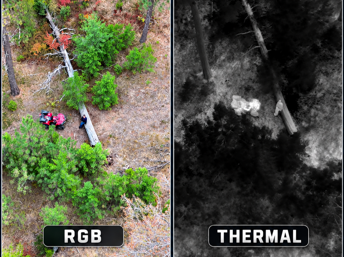
Thermal imaging measures emitted infrared radiation and displays relative temperature differences across a scene. When conditions are appropriate, those differences can reveal patterns and areas of interest that may not be apparent in standard visual imagery.
JCDS combines thermal imagery with high-resolution visual cameras so areas of interest can be evaluated from both perspectives.
Potential applications:
• Building and roof observations
• Electrical and equipment observations
• Livestock monitoring
• Agricultural applications
• Water and irrigation observations
• Search operations
• Lost pet and livestock searches
• Infrastructure inspection
Thermal effectiveness depends on environmental conditions, surface materials, vegetation, weather, solar heating, viewing angle, and other factors. JCDS evaluates conditions when planning thermal operations.
LOOKING FOR A MISSING PET?
Visit our dedicated Lost Pet Search service for search options, pricing, and request information.
MAPPING & GEOSPATIAL
TURN AERIAL IMAGERY INTO A BIGGER PICTURE
Aerial mapping can transform hundreds of individual photographs into detailed, geographically referenced views of a property, field, facility, or project area.
JCDS provides aerial data collection and geospatial deliverables for customers who need more than individual photographs.
Services:
• High-resolution orthomosaic mapping
• Agricultural field mapping
• Property and site documentation
• Elevation and terrain visualization
• Infrastructure mapping
• Progress documentation
• GPS-referenced observations
• GIS-compatible data exports when appropriate
• Historical and repeat-flight comparisons
AERIAL INSPECTIONS
INSPECT MORE FROM A DIFFERENT PERSPECTIVE
Drones can provide detailed visual access to structures, equipment, property, and infrastructure while reducing the need to physically access some elevated, remote, or difficult-to-reach locations.
JCDS uses high-resolution visual, zoom, and thermal imaging capabilities depending on the inspection objective.
Potential applications:
• Roof and building documentation
• Fence-line inspection
• Agricultural infrastructure
• Irrigation systems and pivots
• Tanks, ponds, and water infrastructure
• Facility and property inspection
• Equipment observations
• Construction and project documentation
• Remote or difficult-access areas
JCDS aerial inspections provide imagery and observational information. Where a project requires a licensed engineering, electrical, structural, roofing, or other professional determination, imagery can be provided for evaluation by the appropriate qualified professional.
AERIAL PHOTOGRAPHY & VIDEO
SHOW THE PROPERTY FROM A BETTER PERSPECTIVE
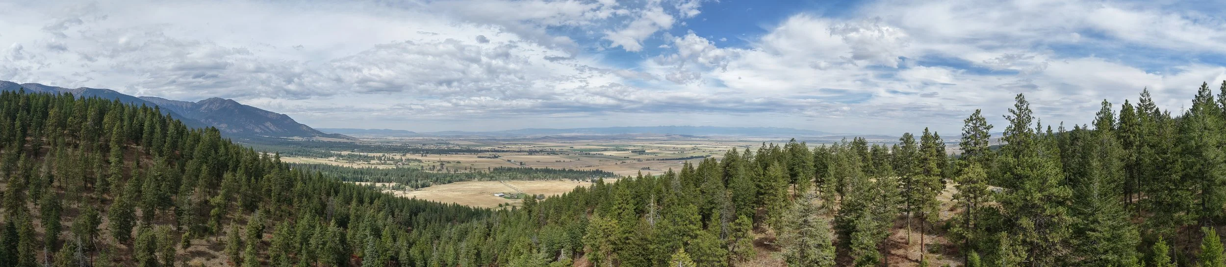
Professional aerial imagery can show the scale, setting, access, landscape, and features of a property in ways ground-level photography cannot.
JCDS provides aerial photography and video for properties, businesses, projects, and marketing applications throughout Eastern Oregon.
Potential uses:
• Real estate
• Rural and recreational properties
• Commercial properties
• Farms and ranches
• Resorts and campgrounds
• Tourism and hospitality
• Development projects
• Construction documentation
• Business marketing
• Social media content
SPECIALIZED APPLICATIONS
HAVE A DIFFERENT PROJECT?
Not every aerial project fits neatly into a standard service category. JCDS can develop project-specific flight and data collection plans for applications where aerial imagery, thermal imaging, multispectral data, mapping, or remote observation may provide useful information.
FEEDLOTS
Thermal observations, facility mapping, drainage documentation, perimeter inspections, livestock monitoring, and recurring aerial documentation.
WINERIES & SPECIALTY CROPS
Multispectral imagery, vegetation assessment, irrigation observations, mapping, and seasonal monitoring.
MINING & RURAL PROPERTY
Site imagery, access documentation, mapping, terrain visualization, and remote-property observations.
GOLF COURSES
Aerial mapping, vegetation imagery, terrain visualization, course documentation, and promotional imagery.
MINING & RURAL PROPERTY
Site imagery, access documentation, mapping, terrain visualization, and remote-property observations.
CAMPGROUNDS & RESORTS
Property mapping, infrastructure documentation, aerial photography, promotional video, and site visualization.
CUSTOM PROJECTS
If you have an application that isn't listed, contact JCDS to discuss whether aerial technology is appropriate for the project.
THE JCDS PROCESS
FROM PROJECT IDEA TO DELIVERABLE
01 — DEFINE
We start by understanding what you need to inspect, document, evaluate, map, or communicate.
02 — PLAN
JCDS evaluates the location, airspace, terrain, conditions, safety requirements, equipment, and appropriate collection method.
03 — FLY
The operation is conducted using flight parameters and imaging systems selected for the project.
04 — DELIVER
Collected imagery and data are organized and processed into the photographs, video, maps, reports, or other agreed deliverables.
NOT SURE WHICH SERVICE YOU NEED?
You don't need to know which aircraft, sensor, or mapping method is appropriate. Tell us what you're trying to accomplish, and we'll help determine whether a drone-based solution is a good fit for the project.
Jaxen Creek Drone Services LLC
Baker City, Oregon
(541) 406-0359
service@jaxencreekdroneservices.com