
THERMAL DRONE PET SEARCH
HELP SEARCH FOR YOUR MISSING PET FROM ABOVE
Jaxen Creek Drone Services uses thermal imaging and high-resolution visual cameras to help search large, wooded, rural, and difficult-to-access areas for missing pets throughout Eastern Oregon.
SEARCH PACKAGES FROM $300
3-Hour • 6-Hour • 10-Hour Search Options
HOW IT WORKS
AERIAL SEARCH. GROUND-LEVEL COORDINATION.
01 - CONTACT JAXEN CREEK DRONE SERVICES
Tell us about your missing pet, the last known location, recent sightings, terrain, and when the pet was last seen.
02 - PLAN THE SEARCH
We evaluate the available information, search area, terrain, weather, airspace, and operating conditions to develop an appropriate aerial search strategy.
03 - SEARCH FROM ABOVE
Thermal and high-resolution visual cameras are used to survey the search area and investigate potential heat signatures or areas of interest.
04 - COORDINATE FINDINGS
Potential sightings and areas of interest are communicated with the owner so they can be evaluated and, when appropriate, investigated from the ground.
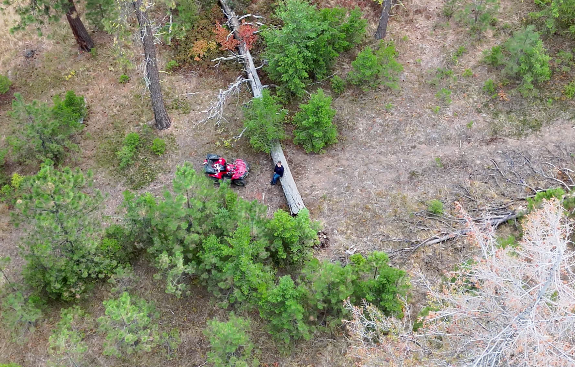
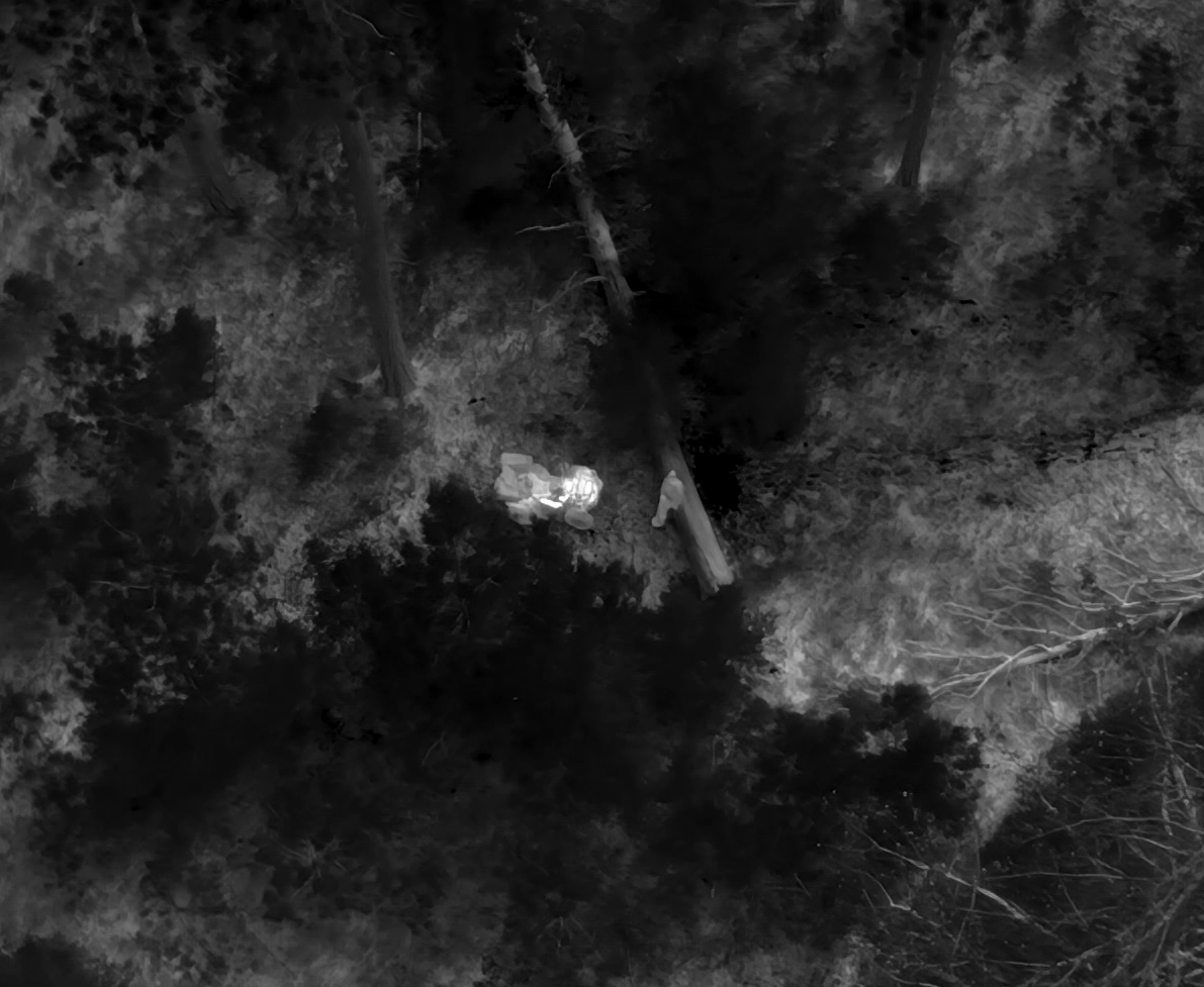
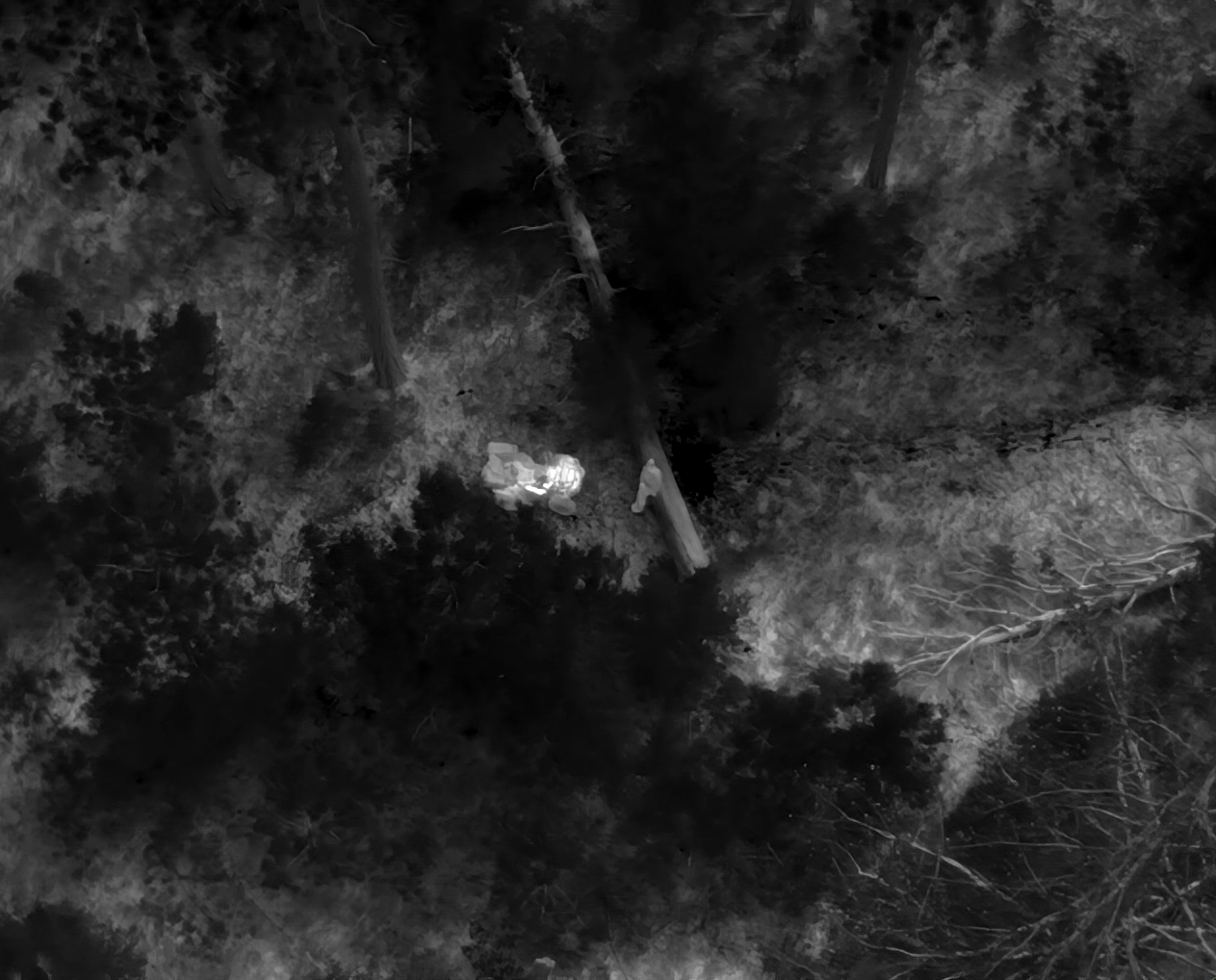
TWO PERSPECTIVES. ONE SEARCH.
Thermal imaging detects differences in emitted infrared radiation, helping reveal heat signatures that may be difficult to distinguish with a standard visual camera.
High-resolution visual imaging is then used to provide additional context and help evaluate areas of interest when conditions permit.
Neither technology guarantees detection. Vegetation, terrain, ambient temperature, weather, distance, animal movement, and other conditions can affect what the aircraft can detect.
FOCUSED SEARCH
$300
UP TO 3 HOURS
1 deployment
Thermal + visual aerial search
Search planning & owner coordination
Up to 75 miles travel included
SEARCH PACKAGES
CHOOSE THE SEARCH THAT FITS YOUR SITUATION
EXTENDED COVERAGE
EXTENDED SEARCH
$500
UP TO 6 HOURS
Up to 2 deployments
Thermal + visual aerial search
Search planning & owner coordination
Search time may be divided between deployments
Up to 75 miles travel included
COMPREHENSIVE SEARCH
$750
UP TO 10 HOURS
Up to 3 deployments
Thermal + visual aerial search
Search planning & owner coordination
Search time may be divided between deployments
Up to 75 miles travel included
MILITARY, VETERAN & EMERGENCY RESPONDER DISCOUNT
10% OFF LOST PET SEARCH PACKAGES
Jaxen Creek Drone Services offers a 10% discount to active-duty military personnel, veterans, and emergency responders. Eligibility verification may be requested.
MULTI-DEPLOYMENT PACKAGES
Extended and Comprehensive Search hours may be divided across their included deployments within the same general search area. Included hours and deployments must be used within 7 consecutive days of the initial deployment unless otherwise agreed by Jaxen Creek Drone Services.
TRAVEL
Travel up to 75 driving miles from Baker City, Oregon is included with each included deployment. Additional round-trip mileage beyond 75 miles is $1.00 per mile.
WHAT DOES “SEARCH TIME” INCLUDE?
Search hours represent active on-site search operations rather than aircraft flight time alone. Search operations may include:
• Aerial search flights
• Battery changes and aircraft preparation
• Repositioning within the designated search area
• Evaluation of potential heat signatures or sightings
• Coordination with the pet owner during the search
• Adjustments to the search plan based on information gathered during the operation
*Travel to and from the general search location is not deducted from purchased search hours.
WHAT IS A DEPLOYMENT?
A deployment is one scheduled JCDS response to the designated search area. A deployment may include multiple individual drone flights, battery changes, repositioning, and other activities necessary to conduct the aerial search.
UNDERSTANDING THERMAL SEARCH CONDITIONS
Thermal imaging can be particularly useful when temperature differences between an animal and its surroundings are easier to distinguish. Cooler conditions often provide better thermal contrast than warm daytime conditions.
Dense vegetation, heavy tree canopy, structures, terrain, warm surfaces, weather, and other environmental factors can obscure or reduce thermal visibility. For this reason, JCDS evaluates current conditions when determining how and when to conduct a search.
EARLY MORNING, EVENING, AND COOLER CONDITIONS MAY PROVIDE BETTER THERMAL CONTRAST.
FAQ
-
No. Drone searches can expand aerial visibility and help investigate areas that may be difficult to search from the ground, but location or recovery of a missing pet cannot be guaranteed.
-
No. Thermal cameras do not see through solid objects or dense vegetation. They detect infrared radiation reaching the sensor. Tree canopy, vegetation and structures can obscure an animal.
-
No. Search timing depends on terrain, weather, airspace, visibility and thermal conditions. Cooler periods can sometimes provide stronger thermal contrast.
-
Yes. Extended and Comprehensive packages may be divided across their included deployments within the same general search area, subject to the package's usage period and operating conditions.
-
Flights are subject to safe weather, airspace and operating conditions. When conditions prevent safe or effective operations, JCDS will coordinate with the owner regarding available options.
-
Each included deployment includes up to 75 driving miles from Baker City, Oregon. Additional round-trip mileage beyond 75 miles is charged at $1.00 per mile.
READY TO START A SEARCH?
The sooner we understand the last known location, recent sightings, terrain, and circumstances surrounding the disappearance, the sooner we can evaluate available search options.
Search results cannot be guaranteed. All operations are subject to weather, airspace, terrain, visibility, FAA requirements, and safe operating conditions.